Section 8: Chart Familiarisation
Next we must become used to using navigational charts - how is information presented on a marine chart, what do the symbols mean, whose charts to buy and which ones, and how to keep charts up to date.
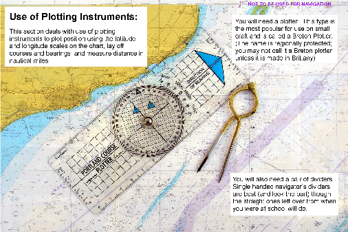
Also we need to know how to use plotting instruments to plot position, direction and distance on the chart.
The section comprises the following:
Basic information - title, source data, scale, date of issue etc
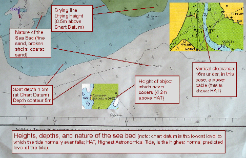
Chart symbols - depths, navigational aids, rocks, wrecks etc
Different types of chart - passage, coastal and harbour plans
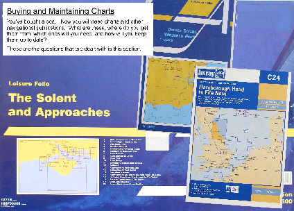
Chart publishers - Admiralty vs commercial charts
Chart updating
Use of chart plotter and dividers